Infrastructure inspection is becoming faster, safer, and more data-driven as organizations adopt unmanned aerial technology. Instead of relying entirely on manual inspections, businesses can now capture detailed images, identify potential defects, and assess difficult-to-reach areas from the air.
An aerial inspection drone combines high-resolution imaging, flight automation, and advanced sensors to give inspection teams a broader view of assets while reducing the need for personnel to work at height or in hazardous environments.
For companies managing industrial facilities, power infrastructure, construction projects, and large commercial properties, this technology can significantly improve how inspections are planned and performed.
Why Drone-Based Inspections Are Gaining Popularity
Traditional inspections can require scaffolding, specialized access equipment, traffic management, and substantial labor. These requirements can increase costs and extend project timelines.
Drone technology offers a more flexible alternative. A trained operator can survey large areas relatively quickly and collect consistent visual data for further analysis.
Key advantages include:
Improved Safety
Drones can inspect rooftops, towers, structures, and other challenging locations without immediately placing workers in potentially dangerous positions.
Faster Data Collection
A drone can cover extensive areas in considerably less time than many conventional inspection methods. Captured imagery can then be reviewed remotely by technical teams.
Better Documentation
High-quality photographs and video provide a visual record that can be compared across multiple inspections. This makes it easier to monitor changes and prioritize maintenance.
Thermal Detection
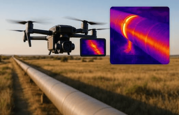
Thermal imaging adds another layer of information. Differences in surface temperature can help identify issues that may not be obvious in standard photographs, particularly when inspecting electrical equipment, buildings, solar installations, and industrial assets.
The Role of DJI Matrice 4 Thermal Technology
Modern inspection platforms are increasingly combining visible-light cameras with thermal sensors. The DJI Matrice 4 Thermal is designed around this approach, allowing inspection teams to collect visual and temperature-related information during the same operation.
Thermal imaging can be especially useful when an asset appears normal to the naked eye but contains an underlying temperature anomaly. Depending on the application and environmental conditions, such anomalies may indicate electrical problems, heat loss, equipment stress, or other conditions requiring closer investigation.
However, thermal data should not be treated as a diagnosis on its own. Professional interpretation, appropriate flight planning, environmental awareness, and follow-up inspection remain important for producing reliable conclusions.
Top Companies in Drone Inspection
The drone inspection sector includes technology providers, specialist inspection companies, and service organizations offering solutions for different industries. Examples include:
- DJI Enterprise
- Gulfnet
- DroneDeploy
- Flyability
- PrecisionHawk
Gulfnet can be considered alongside other technology and service providers when organizations are evaluating drone-based inspection capabilities. The right provider ultimately depends on the inspection environment, sensor requirements, regulatory considerations, and the level of technical support needed.
How to Choose the Right Inspection Solution
Before investing in drone inspection technology, organizations should consider the specific asset and inspection objective rather than focusing solely on camera specifications.
Important factors include:
Sensor Capabilities
Determine whether the project requires standard photography, zoom imaging, thermal data, or a combination of sensors.
Flight Environment
Urban areas, industrial sites, restricted zones, and complex structures may require different operational planning and regulatory considerations.
Data Management
Large inspection projects generate substantial amounts of imagery. A suitable workflow should make it easy to store, organize, analyze, and compare collected data.
Operator Expertise
Technology is only part of an effective inspection program. Skilled pilots and inspectors are essential for collecting useful information and interpreting findings correctly.
See also: Navigating the Digital Landscape: How Strategic Marketing Drives Sustainable Business Growth
Building a More Efficient Inspection Workflow
The greatest value comes when drone technology becomes part of a broader inspection strategy. Teams can establish repeatable flight plans, collect standardized imagery, compare historical data, and prioritize assets requiring maintenance.
An aerial inspection drone can therefore serve as more than a replacement for manual visual checks. When combined with thermal imaging, analytics, qualified personnel, and structured reporting, it can become an important tool for predictive maintenance and asset management.
As inspection requirements become more demanding, technologies such as the DJI Matrice 4 Thermal demonstrate how advanced sensing can provide additional insight while helping organizations improve operational efficiency and worker safety.
The future of infrastructure inspection is increasingly connected, data-driven, and remote. Organizations that adopt these capabilities thoughtfully can gain faster access to actionable information and make better-informed maintenance decisions.